|
||||||||||||||||||||
| 310-374-8047 | ||||||||||||||||||||
|
|||||||||||||||||||||||||||||||||||||||||||||||||||||||||||||||||||||||
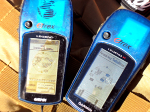
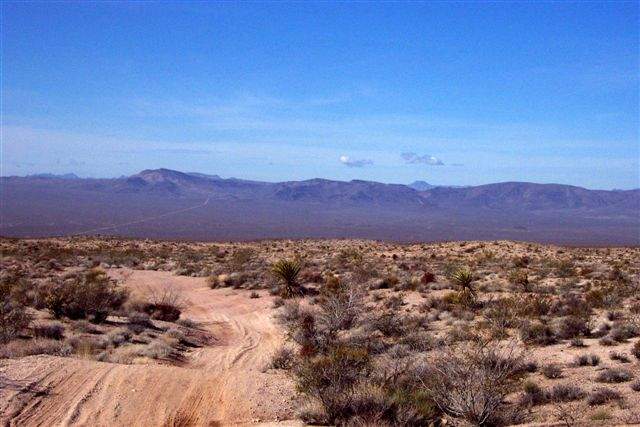
You arrive home after a long drive, turn off the GPS receiver, and say to yourself, Boy, am I glad I have that! How often have you used your GPS system whether in your vehicle or a handheld model while going for a drive or walk? Time was we relied on maps, memory or, in a pinch, the person behind the counter at a gas station. Now, GPS units are so cheap, many people own one, and theyre standard equipment on many vehicles. You can find a basic handheld model for $200 to $300. Better ones, with larger, color screens, maps, and other features, average closer to $400. But like all technology, GPS units have their limitations. Once you understand how the whole process works, youll better appreciate what it can and cannot do. GPS stands for Global Positioning System. Note the last word. The unit you carry and the one in your vehicle are just one component in a complex system. To be technically accurate, your unit is a GPS receiver. Its a multifaceted receiver, but a radio receiver nonetheless. How GPS worksOperated by the Department of Defense, GPS relies on a constellation of 24 satellites orbiting approximately 11,900 miles up. The first satellite was launched in 1978, and the system became fully operational in 1994. Each satellite continuously transmits a series of data, which your GPS receiver uses to determine the time, your location and, in advanced models, altitude and direction of travel.The satellites are in constant movement, making two full rotations around the planet each day. Satellite data contains three parts:
(For a really in-depth explanation of GPS, check out the page on Wikipedia.) At any given time your GPS unit is receiving signals from four or more satellites Your GPS receiver takes that information and, using its own computer, provides the information you see on your screen. So, the more satellites it sees the more accurate its information will be. The satellites transmit at relatively low power (about 50 watts) using two microwave frequencies: 1575.42 MHz (known as L1) and 1227.60 MHz (L2). In addition to preventing jamming, using two frequencies makes it easier for your receiver to account for ionospheric delay error. The satellite information is sent at a fairly slow speed, around 300 baud. Your receiver needs about 25 seconds to download all the information. Thats why it takes so long to orient your unit when you power up. As long as your GPS receiver is on, it is continuously receiving streams of data from the satellites within range. The GPS receiver compares what time it thinks it is and what time the signal was went it left the satellite (included in the data received); that difference is how far away the satellite is. Triangulating from other satellites, the receiver calculates your location. Initially, the DoD placed limitations on the quality of the data being transmitted. Accuracy of the early receivers was about 100 meters. In 2000 the DoD removed that limitation, known as Selective Availability, so current receivers are accurate to within 15 meters (three meters for those with Wide Area Augmentation System capability). Data on the satellites can degrade over time, so new ephemeris data is uploaded on a daily basis (less frequently for the almanac data). Limitations of the Global Positioning System Despite the relatively high-tech nature of the system, GPS has its limitations. And its those limitations that cause the inaccuracies you often see. As mentioned above, your receiver relies on signals sent from satellites in constant motion. As such, anything that affects the signal to ground will affect the information displayed on your screen. Such factors include: Ionosphere and troposphere delaysThe satellite signal slows as it passes through the atmosphere. The GPS receiver uses a built-in algorithm to partially correct for this type of error.Signal multipathThis occurs when the GPS signal is reflected off objects such as tall buildings or large rock surfaces before it reaches the receiver. This increases the travel time of the signal, thereby causing errors.Receiver clock errorsA receiver's built-in clock is not as accurate as the atomic clocks onboard the GPS satellites.Orbital errorsAlso known as ephemeris errors, these are inaccuracies of the satellite's reported location.Number of satellites visibleThe more satellites a GPS receiver can "see," the better the accuracy. Buildings, terrain, electronic interference, or sometimes even dense foliage can block signal reception, causing position errors or possibly no position reading at all. Also, GPS units typically will not operate indoors, underwater or underground.Satellite geometry/shadingThis refers to the relative position of the satellites at any given time. Ideal satellite geometry exists when the satellites are located at wide angles relative to each other. Poor geometry results when the satellites are located in a line or in a tight grouping.Whats the bottom line? A one-microsecond delay in receiving a signal can cause an error of 300 meters. Thats a lot! Looking ahead with GPSA whole new generation of satellites is expected in orbit after 2013. They will feature beam antennas to boost effective power and an enhanced civilian signal structure. Expect to see search and rescue capabilities through use of beacon signals triggered by the receiver. Overall, acquisition time and accuracy should improve, as well. It is believed that the new system, scheduled to be in place by 2020 or 2021. What that means for todays receivers is anyones guess but expect to buy a new receiver to take advantages of the new capabilities.Regardless of what happens with GPS, you should keep traditional methods at hand. Those include a topo map and compass. And, make sure you can read the map! For more on that, see "Know How To Read A Map, And You May Stay Alive" Remember to carry extra batteries for your receiver, and be careful with it. It is sensitive to drops and other hazards. # # # # # |
|
|
Related Articles from Badlands Off-road Adventures |
||
Did you miss the previous article? |
||
Easter Safari April 18, 2011
Sign up for Easter Safari April 18 to 22, 2011 It seems a long ways away, but all the trail rides are assigned by lottery. The submission date for the lottery is somewhere about the end of January to mid February. Most hotels, RV parks and camp grounds need to be reserved this month. They are all close to being sold out. So if you think you might want to go to the Easter Safari this year with Badlands Off-Road Adventures, you need to register soon at http://4x4training.com/calendar/calendar.php#EJS. A few pictures: http://4x4training.com/images/Moab/Moabpicture.html Check out http://4x4training.com/Adventures/EasterSafari/EJSMain.html You can register directly at http://www.4x4training.com/calendar/calendar.php#EJS |
||
March 2011
|
|
|
Sand Clinic February 19, 2011
More details... Register for the Sand Clinic using this link. http://4x4training.com/calendar/calendar.php#Sand |
||
Winch Clinic February 26, 2011
This one day clinic starts with the basics. By the end of the day you will be safely rigging some complex recoveries. It is held near Mojave, CA. More Details... You can register directly at http://www.4x4training.com/calendar/calendar.php#Winch |
||
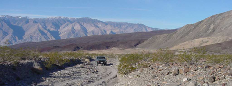
Death Valley
The Death Valley Adventure Starts March 25th. This is a 4 day trip on the back roads in Death Valley. We will drive the Panamint Mountains, drive pass Badwater Basin (lowest spot in North America), visit Chloride Ghost town, Titus Canyon, check out Ubehebe Crater, Teakettle junction, The Race Track & Lippencott Mine Road, camp at the Warm Springs and leave via Steal Pass up to the high meadows, then take Dedeckera Canyon down to the Eureka Sand Dunes. All four days will see some light to moderate 4-wheeling. Much of the trip is quite remote with no cell service. Check out the details and sign up on the website: http://www.4x4training.com/Adventures/Deathvalley.html You can register directly at http://www.4x4training.com/calendar/calendar.php#Deathvalley |
||
Mojave Road
On April 9th we will follow the Old Mojave Road for 3 days. This was the earliest wagon road into California. We will run it east to west just like the wagon trains going to California in the 1800's. We will visit tons of history and see some incredible views. More Details You can register directly at http://4x4training.com/calendar/calendar.php#Mojave |
||
|
|
| Back | | Phone 310-374-8047 |